 An older post of mine talked about looking back at history with the little geodetic survey benchmarks you see in the sidewalk and at the base of older buildings. Modern archaeology has always interested me and if you are interested too, there is a wonderful site documenting abandoned airports around the US named “Abandoned & Little-known Airfields”. It covers the history and evidence left behind when general aviation was more popular and strange little military operations that were out in the middle of nowhere.
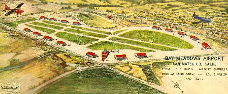
As I have just spent the last 25 or so years living in San Francisco, it was a surprise to find out about strips that I didn’t know about such as the Bay Meadows Airport in San Mateo and the Marina Airfield next to Crissy Field in San Francisco. Marina Airfield was the first terminus of the United States Post Office Department Trans-Continental Air Mail Service.
Growing up in Fresno, I remember the remnants of Furlong Field just out Shaw Avenue. … Good to see it documented here so it isn’t forgotten as development has pretty much obliterated any trace of it.
Sad to see so many fields disappear with the wane of general aviation in this country. It is just too expensive for most to own or lease a plane and keep it up. Land is being sold to developers as cities can see better tax revenue with a shopping center than an air strip.